


.jpeg)


Rajasthan Braces for Storms: Orange Alert Issued as Strong Weather System Turns Active
Rajasthan Weather Update: A strong weather system is active in Rajasthan today, alerting several districts for thunderstorms, rain, and hailstorms. The impact will peak on April 7th, and the weather will return to dryness from April 9th.
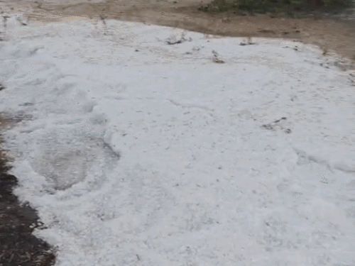
A fresh powerful weather system will start operating in Rajasthan from Monday, leading to fast shifts in the weather in several areas of the state. The Meteorological Department has issued orange and yellow warnings for powerful thunderstorms, rainfall, and hailfall in different regions of Rajasthan from Monday and Tuesday. Around 14 districts have warnings of weather hazards.
The rains and thunderstorms that have been occurring in the past few days lost their intensity on Sunday. Light clouds were spotted in some regions of the Udaipur and Kota regions, while most of the regions remained dry and sunny. Due to the dry and sunny weather conditions, temperatures increased by one or two degrees Celsius in several cities. Dense clouds suddenly covered Jaipur on Sunday evening, bringing pleasant weather after a long day of heat. Cool winds brought relief to the people.
A look at the temperature over the past 24 hours, Barmer was the hottest, with a maximum temperature of 35.1 degrees Celsius. Kota recorded 34, Jodhpur 33.3, Dungarpur 33.3, Jaisalmer 32.9, and Dausa 32.8 degrees Celsius. On Sunday, clouds remained overcast from morning to afternoon in the Kota and Udaipur divisions, but the weather cleared later. Light clouds were visible in Jalore, Sirohi, and Barmer in the evening, although there was no rain.
According to the Meteorological Center, Jaipur, this system, which became active on April 6th, will begin to affect western Rajasthan—Jaisalmer, Jodhpur, Barmer, Bikaner, and Sriganganagar—after noon. Rain accompanied by thunderstorms and hailstorms are expected here. The maximum impact of this weather system will be seen on April 7th, when almost the entire state is expected to be overcast and rain is expected in most areas. After April 9th, the system will weaken, and the weather in the state will return to dry conditions.